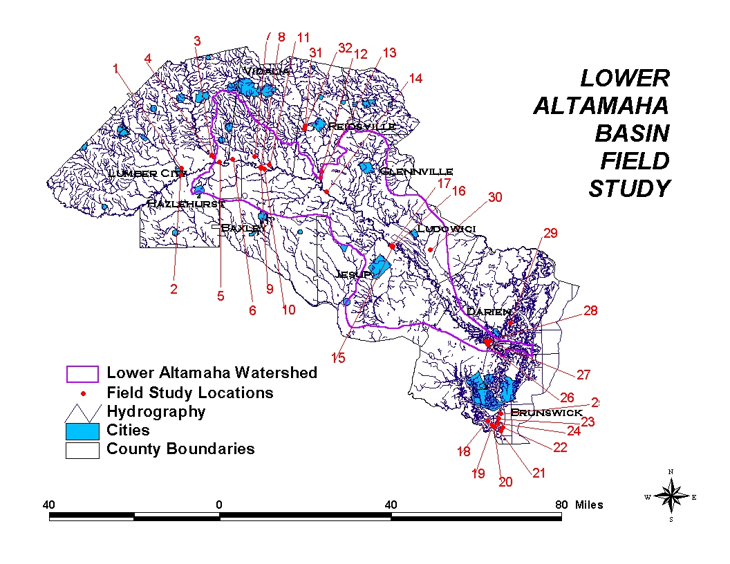
FIELD TRIP
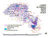 A field trip is conducted on 02-03 June 2001 to obtain a better understanding
of the Lower Altamaha Basin. The field trip covered a total of about 400 miles
along the left and right banks of the Altamaha River and its main
tributaries. Along this 400 mile trip, a total of 10 towns are visited in
southern Georgia, namely: Lumber City, Hazlehurst, Baxley, Jesup, Brunswick,
Darien, Ludowici, Glennville, Reidsville and Vidalia. The main points of
interest are shown in the field trip map given on your right. You may read
the highlights of the field trip in the following paragraphs or you may
download a compact document written in Microsoft
Word 6.0 showing the points of interest in the field trip and the associated
pictures with brief descriptions. The document is approximately 25MB, so please
be patient.
A field trip is conducted on 02-03 June 2001 to obtain a better understanding
of the Lower Altamaha Basin. The field trip covered a total of about 400 miles
along the left and right banks of the Altamaha River and its main
tributaries. Along this 400 mile trip, a total of 10 towns are visited in
southern Georgia, namely: Lumber City, Hazlehurst, Baxley, Jesup, Brunswick,
Darien, Ludowici, Glennville, Reidsville and Vidalia. The main points of
interest are shown in the field trip map given on your right. You may read
the highlights of the field trip in the following paragraphs or you may
download a compact document written in Microsoft
Word 6.0 showing the points of interest in the field trip and the associated
pictures with brief descriptions. The document is approximately 25MB, so please
be patient.
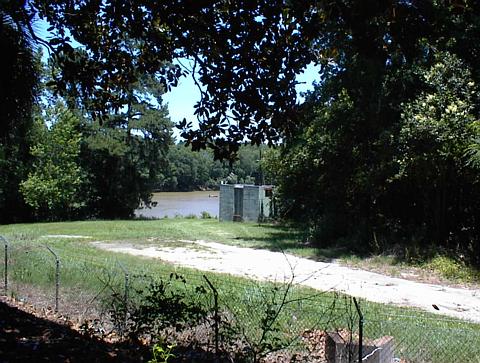
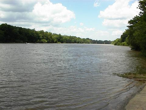
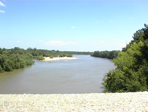
One of the main objective of the field trip was to observe the drainage
characteristics of the watershed. These characteristics are analyzed and are to be used
in river routing and overland flow models. The major drainage pattern of the
southern Georgia is dominated by Ocmulgee and Oconee Rivers, which confluence
near Lumber City to form the Altamaha River. Altamaha then flows to the Atlantic
Ocean in its large floodplain with a meandering pattern. The largest tributary
contribution to Altamaha is the Ohoopee River near Surrency, GA. Below, you will
find some snapshots of the these drainage elements:
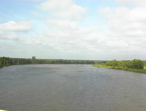
-
Altamaha River looking
upstream near highway bridge on US 221 / GA 135.
-
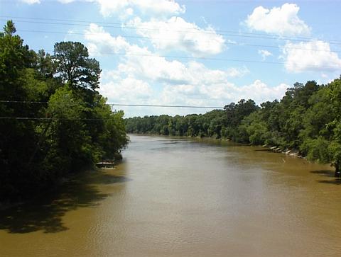
Altamaha River looking
downstream from highway bridge on GA 121/144/169.
-
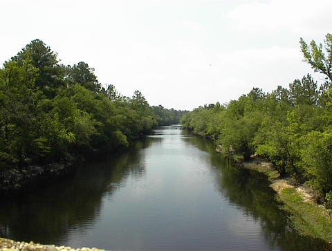
Altamaha River
looking upstream from the highway bridge on US 17 near
Darien, GA.
-
Ocmulgee River
looking upstream towards USGS Gaging Station 02215500 on US 23/341 GA 19/27.
-
Oconee River
looking downstream from highway bridge on CR 95.
-
Ohoopee River
looking downstream from highway bridge on GA 56.
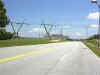
 An important aspect of hydrological modeling is to determine the extent and
timing of the flood peak at a certain location along the river. In this regard,
flow measurements made by the United States
Geological Survey (USGS) are an essential part of hydrological modeling. Of
the several flow gaging stations important to us, the USGS
Gaging Station 02215500 located on the
An important aspect of hydrological modeling is to determine the extent and
timing of the flood peak at a certain location along the river. In this regard,
flow measurements made by the United States
Geological Survey (USGS) are an essential part of hydrological modeling. Of
the several flow gaging stations important to us, the USGS
Gaging Station 02215500 located on the 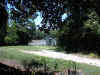 Ocmulgee
River on US 23/341 GA 19/27 is shown to your right. This station is a real-time
station, which sends its recorded data to the main server on a regular basis.
Another real-time recording station is the USGS
Gaging Station 02225000 located next to the highway
Ocmulgee
River on US 23/341 GA 19/27 is shown to your right. This station is a real-time
station, which sends its recorded data to the main server on a regular basis.
Another real-time recording station is the USGS
Gaging Station 02225000 located next to the highway bridge
on US 221 / GA 135 shown to your left. This station is also a real-time station
and collects data from the Altamaha River. Last but not the least, the USGS
Gaging Station 02225500 on Ohoopee River is shown to your right. The Ohoopee
River is a major tributary of the Altamaha River and is located near Reidsville,
GA.
bridge
on US 221 / GA 135 shown to your left. This station is also a real-time station
and collects data from the Altamaha River. Last but not the least, the USGS
Gaging Station 02225500 on Ohoopee River is shown to your right. The Ohoopee
River is a major tributary of the Altamaha River and is located near Reidsville,
GA.
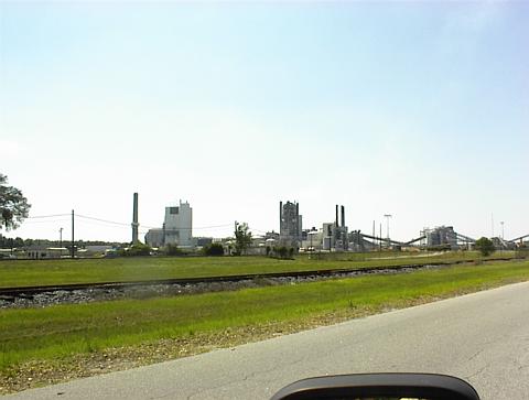
 Two major industrial facilities located in the Lower Altamaha watershed are the
Edwin Hatch Nuclear Power Plant (shown left) near Baxley, GA and the Rayonier
Pulp Mill (shown right) near Jesup, GA. Both facilities are established along
the right bank of Altamaha. The Edwin Hatch Nuclear Power Plant has two units
giving a total of 1630 MW generation capacity
Two major industrial facilities located in the Lower Altamaha watershed are the
Edwin Hatch Nuclear Power Plant (shown left) near Baxley, GA and the Rayonier
Pulp Mill (shown right) near Jesup, GA. Both facilities are established along
the right bank of Altamaha. The Edwin Hatch Nuclear Power Plant has two units
giving a total of 1630 MW generation capacity 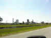 and
is operated by the Southern Company. The
Rayonier Pulp Mill produces 570,000 ton
per year premier grades of chemical cellulose or dissolving pulps used in the
finest products around the world. Both the Hatch Plant and the Rayonier Mill is
located next to two flow gaging stations. The Hatch Plant is located right next
to the USGS
Gaging Station
02225000 and the Rayonier Plant is located next to USGS
Gaging Station 02226000.
and
is operated by the Southern Company. The
Rayonier Pulp Mill produces 570,000 ton
per year premier grades of chemical cellulose or dissolving pulps used in the
finest products around the world. Both the Hatch Plant and the Rayonier Mill is
located next to two flow gaging stations. The Hatch Plant is located right next
to the USGS
Gaging Station
02225000 and the Rayonier Plant is located next to USGS
Gaging Station 02226000.
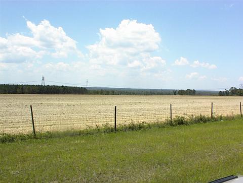
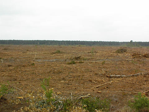
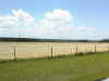 One other important objective of the field trip was to have a sound
understanding of land cover/use characteristics of the watershed that becomes
significant in determining
One other important objective of the field trip was to have a sound
understanding of land cover/use characteristics of the watershed that becomes
significant in determining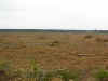 the
hydrological response to a meteorological event. The Lower Altamaha watershed is
mostly covered by forests and wetlands. Agricultural land (shown left) is
observed at relatively high elevations of the watershed. The world-famous Vidalia
onions are produced in the basin. The high forest cover in the watershed
supported lumber industry. Typically, forest plantations are clear cut (shown
right) to harvest the timber and replanted again.
the
hydrological response to a meteorological event. The Lower Altamaha watershed is
mostly covered by forests and wetlands. Agricultural land (shown left) is
observed at relatively high elevations of the watershed. The world-famous Vidalia
onions are produced in the basin. The high forest cover in the watershed
supported lumber industry. Typically, forest plantations are clear cut (shown
right) to harvest the timber and replanted again.
Back
to Altamaha Homepage
Back to MESL Homepage
 A field trip is conducted on 02-03 June 2001 to obtain a better understanding
of the Lower Altamaha Basin. The field trip covered a total of about 400 miles
along the left and right banks of the Altamaha River and its main
tributaries. Along this 400 mile trip, a total of 10 towns are visited in
southern Georgia, namely: Lumber City, Hazlehurst, Baxley, Jesup, Brunswick,
Darien, Ludowici, Glennville, Reidsville and Vidalia. The main points of
interest are shown in the field trip map given on your right. You may read
the highlights of the field trip in the following paragraphs or you may
download a compact document written in Microsoft
Word 6.0 showing the points of interest in the field trip and the associated
pictures with brief descriptions. The document is approximately 25MB, so please
be patient.
A field trip is conducted on 02-03 June 2001 to obtain a better understanding
of the Lower Altamaha Basin. The field trip covered a total of about 400 miles
along the left and right banks of the Altamaha River and its main
tributaries. Along this 400 mile trip, a total of 10 towns are visited in
southern Georgia, namely: Lumber City, Hazlehurst, Baxley, Jesup, Brunswick,
Darien, Ludowici, Glennville, Reidsville and Vidalia. The main points of
interest are shown in the field trip map given on your right. You may read
the highlights of the field trip in the following paragraphs or you may
download a compact document written in Microsoft
Word 6.0 showing the points of interest in the field trip and the associated
pictures with brief descriptions. The document is approximately 25MB, so please
be patient. 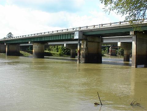