![]()


BACKGROUND
Oregon State Pen.
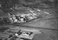
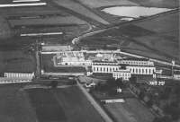
The Oregon State Penitentiary (OSP) is approximately 306.3 acres and is located at 2605 State Street, Salem, Oregon, approximately one-half mile west of Interstate Highway 5 in Salem, Marion County, Oregon [Figure ES-1, SECOR, 1998]. The state of Oregon has owned and operated the subject property as the Oregon State Penitentiary since approximately 1865. Included on the OSP site are prison inmate living buildings and working facilities. The working facilities include the Motor Pool, the Industries Metal Shop, the Vocational Training Building, the Physical Plant Building, and the Industries Laundry facility. The Industries Laundry facility is located in the northwest quadrant of the OSP property and currently includes approximately 28,880 square feet of building space. Although not verified, the SECOR reports suggest that the source of groundwater contamination is associated with the past operation of the Industries Laundry facility. Dry cleaning and laundering operations have occurred at the site since late 1950s.
Oregon State Pen.
In this study the results of a preliminary contaminant fate and transport analysis conducted at the OSP, Salem, Oregon is summarized. In this analysis, the Analytical Contaminant Transport Analysis System (ACTS) software is used. The purpose of this work is to assess the distribution of the Trichloroethene (TCE) and the Tetrachloroethene (PCE), determine the potential groundwater exposure pathways of TCE and PCE at the OSP site and provide recommendation for further studies. The site specific data are obtained from site investigation reports prepared by SECOR (1998) and SEACOR(1994).
Identification of Contamination Sources at the OSP Site
The groundwater samples obtained from the on-site OSP water supply wells were analyzed in October 1989. The sampling results indicated the presence of various Halogenated Volatile Organic (HVO) compounds, including TCE, PCE, dichloroethene (DCE), and vinyl chloride (VC). The highest concentrations were detected in the old OSP water supply Well No. 3 located at the northwest corner of the OSP site. A Preliminary Assessment at the OSP site in 1991 identified the discharge of non-contact cooling water used by the facility dry cleaning operation as a potential migration pathway for PCE to subsurface soil and groundwater. The cooling water was discharged to the storm sewer on the east side of the Industries Laundry building. Site investigation results show that PCE and TCE concentrations were detected in monitoring wells MW-1, MW-2, MW-2I, MW-2D, MW-5, MW-7, MW-8, and MW-9. The highest contaminant concentrations were consistently detected in groundwater samples collected from MW-5, which is located at the east side of Industries Laundry building.
Groundwater was sampled from the shallow aquifer zone, the intermediate aquifer zone, and the deep aquifer zone. The highest HVO concentrations were observed in the shallow zone at well MW-5, which is located just east of the present Industries Laundry facility. The TCE concentration up to 600 µg/L has been detected from MW-5. The distribution of TCE concentration detected in July, 1996 based on the shallow monitoring well data are illustrated in Figure 1. Similarly, the PCE concentration as high as 17,000 µg/L has also been detected at MW-5 in the shallow aquifer. In addition, PCE concentrations of 930 µg/L, 1,000 µg/L, and 220 µg/L have been measured in down gradient monitoring wells MW-2, MW-9, and MW-10, respectively, Figure 2. The major HVO release from the Industries Laundry facility is PCE and the presence of TCE is most likely due to the degradation of PCE. The analytical results of discrete groundwater samples collected during the drilling of the monitoring wells indicate large variation of HVO concentration vertically.
Hydrogeologic Characteristics of the OSP Site
The primary aquifer at the OSP site is the Troutdale Formation. The Troutdale formation ranges in thickness from 120 to 260 feet at the site. There are three groundwater zones in the Troutdale aquifer: the shallow zone, intermediate zone and the deep zone (Figure ES-5, SECOR, 1998). The shallow zone in the OSP study area is defined as the uppermost portion of the saturated zone of the Troutdale Formation with the bottom at approximately 30 to 40 feet below ground surface. The intermediate zone extends from the bottom of the shallow zone to approximately 100 feet below ground surface. Between the shallow zone and the intermediate zone is a gravelly clay layer of low hydraulic conductivity. The deep zone of the aquifer extends from the bottom of the intermediate zone to approximately 130 feet below ground surface. Similarly there is a gravelly clay layer of low hydraulic conductivity between the intermediate zone and the deep zone. Within the vicinity of the OSP facility, the bottom of the deep zone corresponds to a low hydraulic conductivity layer overlying the Columbia River Basalt (CRB).
Based on water level data collected from the groundwater monitoring wells, the inferred groundwater flow direction in the three groundwater zones of the Troutdale Formation is oriented in a northwesterly direction. The average groundwater level gradients are 0.006 ft/ft, 0.004 ft/ft, and 0.0045 ft/ft for the shallow, intermediate, and deep zones respectively at the OSP site study area (SECOR, 1998). The static water level data collected from the OSP site also indicated the existence of vertical gradients between the shallow, intermediate, and deep zones of the Troutdale Formation. A pumping test was conducted at the Suburban East Salem Water District (SESWD) LaBranch Street Well No. 3-A. This test indicated the average transmissivity value of the Troutdale Formation is approximately 3.4 ft2/min with a storativity of 3.3 x 10⁻⁴. In addition to the SESWD pump test, limited aquifer recovery tests were conducted at off-site wells MW-11M and MW-12M during drilling to determine more site-specific values of transmissivity. Analyses of the recovery test data indicated transmissivity values ranging from 0.0034 to 0.016 ft2/min.
Assumptions and Simulation Parameters
The hydrogeologic setting at the OSP site is rather complicated. There are three groundwater flow zones in the Troutdale Formation. Field investigations at the site indicate the existence of vertical hydraulic gradients between shallow, intermediate, and the deep aquifer zones. There are flow interaction between these zones and the groundwater flow direction among these zones may vary spatially. Based on the results of field investigations (SECOR, 1998), the Industries Laundry building is the potential location of the contaminant source. In the analysis presented in this report, the location of the monitoring well MW-5 will be treated as the approximate location of the contaminant sources. The x- and y- coordinate directions selected in the ACTS simulations are shown in Figure 1 and Figure 2. The x-axis direction is selected in the main groundwater flow direction which is towards the Northwest and the coordinates of the monitoring well MW-5 is defined as the origin of the coordinates. In our preliminary investigation of the PCE and TCE fate and transport conditions at the site, the groundwater flow is assumed to be steady and the vertical flow interaction between different aquifer zones is neglected. The contaminant simulations are done separately for PCE and TCE for the shallow zone and the chemical interaction between PCE and TCE is also neglected. The parameters used for one-dimensional and two-dimensional PCE and TCE fate and transport simulations are given in Table 1 and the Monte Carlo simulation parameters are shown in Table 2.
Evaluation of TCE and PCE Fate and Transport at OSP
TCE and PCE fate and transport simulations are conducted using the ACTS screening models (Aral, 1998). For each contaminant, simulations are done using one-dimensional analytical transport model and two-dimensional analytical transport model separately. To evaluate the effect of uncertainty of the parameters on the TCE and PCE fate and transport, Monte Carlo simulations are also performed for each contaminant. The evaluation of the results of TCE and PCE fate and transport analysis are summarized in the following sections.
TCE and PCE Fate and Transport
Simulations For the one-dimensional model, the flow direction is in the x-axis direction, the source of TCE and PCE contamination is along the y-axis at x = 0, Figure 1. The PCE concentration at the source location is assumed to be 17,000 µg/L, which is the highest PCE concentration detected at the OSP site. Similarly, the TCE concentration at the source location is assumed to be 600 µg/L, which is also the highest TCE concentration detected at the OSP site. Since lateral dispersion is neglected in one-dimensional models, the simulated TCE and PCE concentrations are conservative and generally larger than their field measurements. However, one-dimensional simulation results may provide useful information on the upper limit of the contaminant concentrations.
The aquifer and chemical parameters used in the TCE and PCE fate and transport simulations are shown in Table 1. As shown in this table, the average groundwater flow velocity (Vx = 0.67 ft/day), the longitudinal dispersion coefficient (Dx = 67 ft2/day) are selected as representative values. The contaminant half-life is assumed to be very large for both PCE and TCE representing conservative contaminant. The retardation coefficient for PCE is 1.979 and that for TCE is 1.409. The difference between these retardation coefficients will result in different transport velocities for PCE and TCE. The travel times for PCE and TCE contamination to migrate to selected locations at the site are summarized in Table 3 and Table 4 respectively.
The OSP property boundary is about 1140 ft down-gradient to the source at the Industries Laundry building. As shown in Table 3 and Figure 4, TCE concentration at the OSP property boundary may be reached to the level of 1%, 5%, 10% and 20% of the TCE source concentration in approximately 2.3, 3.1, 3.7, and 5 years respectively. The travel time for PCE to reach the same percent source concentration levels at the OSP property boundary is larger. It takes approximately 3.2, 4.3, 5.1, and 7 years for PCE at the OSP property boundary to reach 1%, 5%, 10% and 20% of the source concentration respectively, Table 4. The numerical results also show that it takes about 7 years for TCE and 10 years for PCE to reach 10% of their source concentration level at the 24th street location. Based on the one-dimensional simulation results, the TCE plume will migrate a half mile distance in approximately 10 years and a one mile distance in approximately 22 years. As should be expected, the PCE plume migrates slower than the TCE plume. The PCE front will migrate a half mile distance in approximately 13 years and a one mile distance in approximately 30 years. The Willamette River is approximately 10,400 ft down-gradient from the source location. Based on one-dimensional simulation results, TCE concentration at the river will be 1%, 5% and 10% of the source TCE concentration in approximately 42, 47, and 49 years, Table 3. It takes approximately 66 years for PCE concentration at the river to reach 5% of PCE source concentration, Table 4.
The parameters used in two-dimensional fate and transport simulations are similar to that used in one-dimensional simulation models. The groundwater flow direction is still in the x-axis direction and the groundwater velocity in the y-direction is assumed to be zero. The aquifer is assumed to be 1000 ft wide in the y-axis direction. The central point of the contaminant source is assumed to be the location of monitoring well MW-5 and the length of the contaminant source is assumed to be 50 ft along the y-axis. In the two-dimensional models, the lateral dispersion of the TCE and PCE plume is taken into account. The lateral dispersion coefficient is selected to be 10% of the longitudinal dispersion coefficient, which is commonly used in the literature. The results of the two-dimensional TCE and PCE fate and transport simulations are presented in the report submitted to ATSDR. Similar to one-dimensional models, the travel time for PCE and TCE to migrate to selected locations are summarized in Table 3 and Table 4 respectively.
Based on the two-dimensional simulation results, TCE concentration at the OSP property boundary will reach 1%, 5%, and 10% of the source TCE concentration in approximately 2.6, 4.7, and 7 years respectively, Table 3. The TCE concentration at the OSP property boundary is less than 20% of the source TCE concentration due to retardation and lateral dispersion of TCE contamination for very large travel times. As shown in Table 4, it takes approximately 4.2, 6.5, and 9.5 years for PCE concentration at the OSP property boundary to reach 1%, 5%, and 10% of the source PCE concentration respectively. Similar to TCE, the PCE concentration at the OSP property boundary is also less than 20% of its source concentration for very large travel times. The approximate travel times for the TCE plume to migrate to the 24th street area, half mile, and one mile down-gradient locations from the source are approximately 6.5, 10, and 24 years respectively, Table 3. The travel times for the PCE plume to reach these locations are larger. It takes approximately 9, 13, and 34 years for the PCE plume to reach the 24th street area, half mile, and one mile down-gradient region respectively, Table 4. As shown in Table 3, the TCE concentration at the Willamette River will reach 1% and 5% of the source TCE concentration in approximately 53 and 76 years respectively. The PCE concentration at the Willamette River will be 1% of the source PCE concentration in about 74 years. It will take more than 100 years for the PCE concentration at the Willamette River to reach 5% of the source concentration, Table 4 and Figure 12. The TCE and PCE concentrations at the Willamette River is less than 10% of their source concentration for travel times larger than 100 years.
The TCE and PCE concentrations and the travel times obtained from two-dimensional simulations are smaller than those obtained from one-dimensional simulations. This is mainly due to lateral spread of the plume in two-dimensional application. Based on the results of one- and two-dimensional simulations, the travel time for the TCE plume to reach the OSP property boundary is approximately 2.3 to 2.6 years and that for the PCE plume is approximately 3.2 to 4.2 years. The time for the TCE plume to migrate to the 24th street area is approximately 5.6 to 6.5 years and that for PCE plume is approximately 7.2 to 9.2 years. The time for the TCE plume to migrate to the Willamette River are approximately 42 to 53 years and that for PCE would range from 60 to 74 years. These simulated travel times are close to 60 to 80 years that are estimated by SECOR (1998). However, the simulated travel times in this preliminary investigation are smaller than the travel times estimated in SECOR (1998). This is due to consideration of longitudinal dispersion of the plumes, which generally increase the transport velocity of the plumes. It is also shown in the results that the TCE plume moves faster than the PCE plume. This is because the retardation coefficient for the PCE is larger than that for TCE at the OSP site.
Monte Carlo Simulations of TCE and PCE Fate and Transport Analysis
Monte Carlo simulation could be used to evaluate the effect of uncertainty of the parameters used in evaluation of TCE and PCE fate and transport on the results. The range of parameters used in the Monte Carlo simulations are shown in Table 2. For this preliminary study, the uncertainty of the retardation coefficient, the pore groundwater velocity, the longitudinal dispersion coefficient, and the lateral dispersion coefficient are simulated. The groundwater flow velocity is assumed to follow the normal distribution. Estimates for the mean minimum, and maximum velocity are 0.67, 0.54, and 0.80 ft/day, respectively. The variance is assumed to be [10% × (0.80-0.54)]2 = 0.0007. The longitudinal dispersion coefficient and the lateral dispersion coefficient are also assumed to follow the normal distribution. Estimates for the mean, minimum and maximum values of the longitudinal dispersion coefficient are 67, 47, and 87 ft2/day, respectively. The variance of the longitudinal dispersion is assumed to be 16. Estimates for the mean, minimum and maximum values for the lateral dispersion coefficient are 6.7, 4.7, and 8.7 ft2/day, respectively. The variance of the lateral dispersion coefficient is assumed to be 0.16. The retardation coefficients are also assumed to follow the normal distribution. The mean, minimum and maximum values of the retardation coefficient of TCE contamination are 1.409, 1.0, and 2.0 respectively. The variance of the retardation coefficient of TCE is assumed to be 0.01. For PCE, those ranges are 1.979, 1.0, and 2.5 respectively with the variance to be 0.023. The Monte Carlo simulation results for TCE are summarized in Table 5 and that for PCE are summarized in Table 6. All of these simulations are performed for two dimensional models.
Base on the Monte Carlo simulations of TCE fate and transport, TCE contamination is very unlikely to contaminate the area outside of the OSP property in 2 years. The Probability of TCE concentration at the OSP property boundary exceeding 1% of the source TCE concentration in 2 years is about 0.26%. However, the TCE will contaminate the OSP property boundary area in 5 years. The probability of TCE concentration exceeding 5% of the source TCE concentration in 5 years is 100% and that exceeding 10% of the source TCE concentration is 51.2%. TCE contamination will migrate to 24th street area in 10 years. The probability of TCE concentration exceeding 5% of the source TCE concentration at 24th street in 10 years is 100% and that exceeding 10% of the source TCE concentration is 1.6%. The TCE plume will migrate one mile down-gradient to the source location in 20 to 30 years. TCE may migrate to the Willamette River in 40 to 50 years. The TCE concentration at the Willamette River will be 1% of the source TCE concentration in approximately 40 years with the probability of exceedance to be 97% and 5% of the source TCE concentration in 60 years with the probability of exceedance to be 97.4%.
The results of Monte Carlo simulations of PCE fate and transport are very close to that of TCE. As shown in Figures 25 through 27 of the report submitted to ATSDR, it is very unlikely that PCE will migrate to the area down-gradient to the OSP property boundary in 2 years, the probability of PCE concentration at the OSP property boundary exceeding 1% of the source PCE concentration in 2 years is about 0.22%. However, PCE will contaminate this area in 5 years, the probability of PCE concentration exceeding 5% of the source PCE concentration in 5 years is 96.6%. PCE will also migrate to the 24th street area in 10 years. The probability of PCE concentration exceeding 5% and 10% of the source PCE concentration at 24th street in 10 years are 100% and 1.6% respectively. PCE will migrate one mile down-gradient from the source location in 20 to 30 years, but it is not likely to migrate this far in 15 years. The probability of PCE concentration exceeding 1% of the source PCE concentration at the one-mile down-gradient region in 15 years is approximately 0% and that in 20 years is 99.9%. Similar to TCE, the PCE plume may contaminate the Willamette River region in approximately 40 to 50 years. The probability of PCE concentration exceeding 1% of the source PCE concentration at the Willamette river in 40 years is 96.9%.
The maximum and minimum TCE and PCE concentrations at the steady state or at very large travel times obtained from Monte Carlo simulations are a function of distance down-gradient to the contaminant source. The simulated maximum and minimum TCE and PCE concentrations are shown in Figures 37 and 38 respectively in the report submitted to ATSDR. As expected, larger the distance down-gradient to the contaminant source results in smaller TCE and PCE concentrations. As shown in these Figures, the maximum and minimum TCE and PCE concentrations at the Willamette River are approximately 5% of their source concentration at very large travel times.
CONCLUSIONS
Based on our preliminary evaluation of contaminant fate and transport conditions at the OSP, Salem, Oregon using the Analytical Contaminant Transport Analysis System (ACTS) software (Aral, 1998), the following conclusions may be reached:
i. Data collected at the field suggest that the source of groundwater contamination is the past operation of the Industries Laundry facility at the OSP site and source contamination may have occurred as early as late 1950s (SECOR, 1998).
ii. Data collected at the OSP site show that groundwater in the shallow aquifer at the OSP property and downstream to the OSP property boundary has been contaminated by TCE and PCE contamination, Figure 1 and Figure 2.
iii. Data collected at the field indicate that the PCE plume concentration is much higher than the TCE plume concentration, Figures 1 and 2. For instance, the maximum PCE concentration detected at the OSP site is approximately 17,000 µg/L and the maximum TCE concentration is approximately 600 µg/L. This may be an indication that PCE is the precursor chemical released into the environment and the presence of TCE is mostly due to the degradation of PCE (SECOR, 1998).
iv. Simulation results show that it takes less than 5 years for TCE and PCE contamination to migrate out of the OSP property boundary in a down-gradient direction from the Industries Laundry building.
v. Based on our simulation results as well as the field investigation performed by SECOR(1998), shallow groundwater at 24th street area which is downstream to the Industries Laundry building has been contaminated. Simulation results show that it takes less than 10 years for TCE and PCE contamination to migrate to the 24th street area.
vi. Simulations results indicate that it takes 20 to 30 years for TCE and 30 to 40 years for PCE contamination to migrate one mile downstream of the Industries Laundry building. Based on the observation that dry cleaning and laundering operations have occurred at the site since late 1950s and based on our simulation results, PCE and TCE plume would have reached the area one mile downstream of the source location at the present time. However, there is no field evidence that PCE or TCE plume have migrated this far. This may be because of the fluctuations in the natural piezometric head gradients and the associated change in groundwater flow velocity magnitude and directions. This may also be due to the pump and treat system implemented at the site during the last 40 years. It should be mentioned that if no corrective action was implemented, TCE and PCE contamination would have reached the area one mile downstream from the source.
vii. If no corrective action is taken, it will take 50 to 60 years for TCE and PCE plumes to reach and contaminate the Willamette River through the shallow groundwater flow pathway. Since contaminants has been released to groundwater since late 1950s, TCE and PCE contamination may reach the Willamette River approximately during the year 2020 if no corrective action is implemented.
viii. PCE is the primary contaminant released to the environment at the OSP site and TCE might be the results of PCE degradation. However since TCE contamination migrates faster than PCE contamination, TCE plume may move ahead of the PCE plume and TCE should also be included into the future evaluation of contaminant fate and transport analysis and field studies at the OSP site.
It should be mentioned that the preliminary evaluation of TCE and PCE fate and transport analysis at the OSP site is based on several simplifying assumptions. These are:
(i) the groundwater flow is steady; and,
(ii) the flow in vertical directions between different aquifer layers are neglected.
The contaminant transport simulations are done separately for PCE and TCE for the shallow zone and the interaction between PCE and TCE are also neglected. The fluctuations of groundwater flow velocity and direction change as well as flow interaction between different aquifer layers may affect fate and transport conditions at the OSP site significantly. Also degradation of PCE may affect PCE and TCE concentrations at the site. Further investigation of the effect of groundwater table fluctuation and the flow interaction between different aquifer layers, as well as the analysis of the effect of chemical interaction between these two species on the fate and transport processes at the OSP site is strongly suggested.
![]()